


Possible Ancient Stonework On the Shores of Vermont’s Glacial Lakes and Seas
Potential Stone Constructs Dating Back Into The Ice Age

Potential Stone Constructs Dating Back Into The Ice Age
I do love a good map.
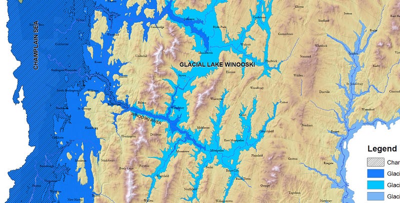
This one depicts the glacial lakes and seas that filled much of the Champlain Valley and beyond towards the end of the last Ice Age, for a time even connecting to the Atlantic Ocean. After the weight of the ice sheets lifted, the earth’s crust rebounded. Land that was at sea level over 10,000 years ago is now a few hundred feet above sea level, all around our smaller Lake Champlain.
The work of Vermont researchers George Springston of Norwich University, Stephen Wright of the University of Vermont and John van Hoeven of Green Mountain College, this map of Major Glacial Lakes and The Champlain Sea, Vermont, 2020 has been helpful as I’ve found a great deal of interesting stonework along what used to be the shoreline of the Champlain Sea.
The PDF of the map let me roughly chart the shoreline’s estimated current location. Very roughly. (PDF: https://anrweb.vt.gov/PubDocs/DEC/GEO/MiscPubs/SpringstonGlacialLakes2020opt.pdf).
I finally found an online, interactive version of this map at the state’s Vermont Open Geodata Portal which lets you zoom in as well as select which Glacial Lake Phase or the Champlain Sea to overlay. We can see the approximate locations of the ancient shorelines in much closer detail (https://geodata.vermont.gov/datasets/VTANR::glacial-lakes-and-the-champlain-sea/explore).
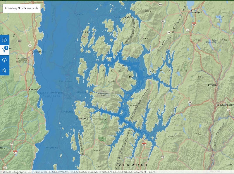
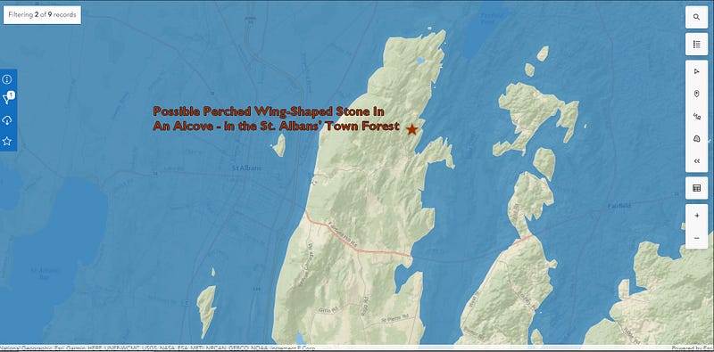
It is nice having this interactive map to play with, as Vermont’s winter snows can throw a literal wet blanket over most stone side exploration, and this year it got snowy late. Looking at Glacial Lake Vermont in its Coveville Phase wrapping around the Saint Albans’ Town Forest led me to look back on footage and photographs I’d shot there last Spring. I also began working on a video production on the visit, as I’d not had a chance to put one together since I’d gone up there.
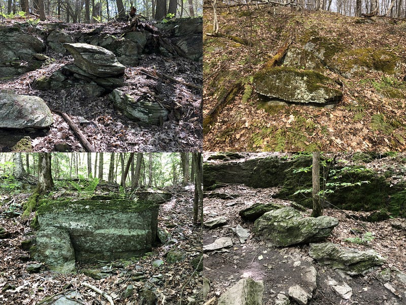
Frankly, I didn’t find much in the way of definitive stonework in the Town Forest during my visit last April, although I did find a potential stone feature, one whose design I’ve not seen noted elsewhere, but one which I have seen elsewhere around the Champlain Valley here in Vermont. Assembling a new video presentation on the visit to the Saint Albans’ Town Forest last Spring allowed me to explore the concept further.
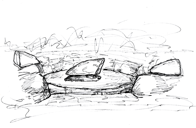
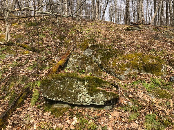
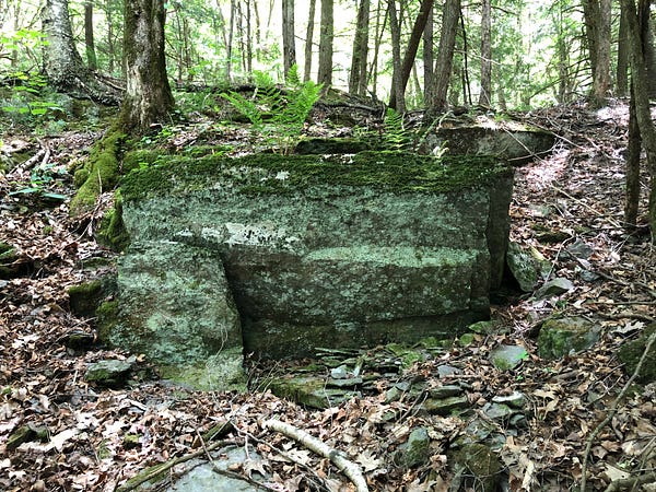
I call this possible feature a Perched Wing-Shaped Stone In An Alcove. A Wing-Shaped Stone, or assemblage of stones, is apparently deliberately perched in the center, the middle, of a seemingly intentional space — a concave alcove either built up or carved out around it.
I’ve drawn an example to illustrate the concept:
The Perched Wing Shaped Stone in the Saint Albans’ Town Forest sits in the center of what’s now a leaf and duff filled alcove.
Comparing the glacial seas map against the hiking trails map showed it was near ancient shores, but well above the heights of the Champlain Sea 10,000 years ago. This feature instead was on the shore of earlier Lake Vermont in its Coveville Phase, 13.5 to 14.5 thousand years ago.
As I stood there, I imagined looking out from the alcove to the chilly waves on the ancient glacial lake…
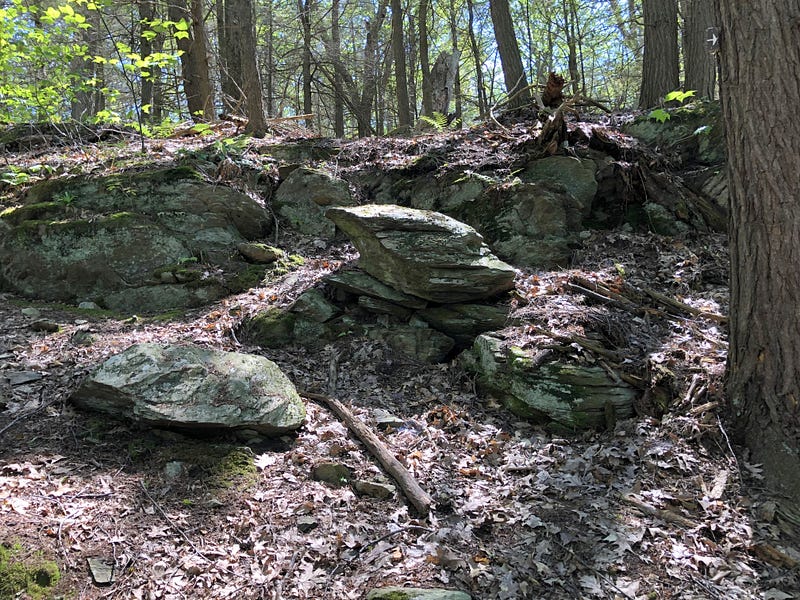
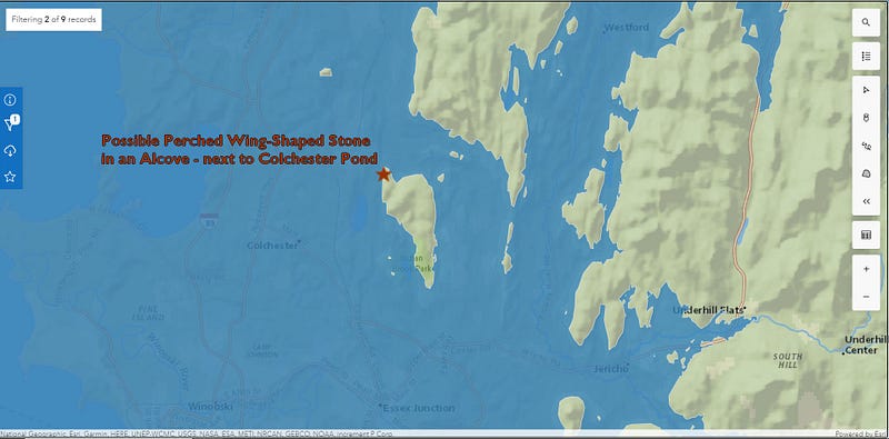
One of the first Possible Perched Wing Stones in an Alcove I’d found was on a ridge Northeast of Colchester Pond. Checking the map? Sure, it was above the Champlain Sea — well above — but it was also the Northern tip of a land mass, with the Wing in an Alcove right on the shore, on Lake Vermont in its Coveville Phase. Another shoreline correlation with the glacial lake at its largest extant.
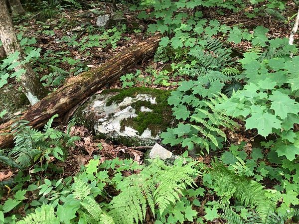
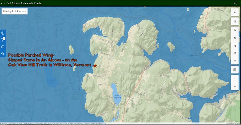
I found another possible example in Williston, Vermont, in Sucker Brook Hollow, again on the shore of Lake Vermont in the Coveville Phase.
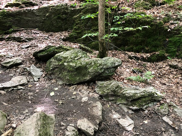
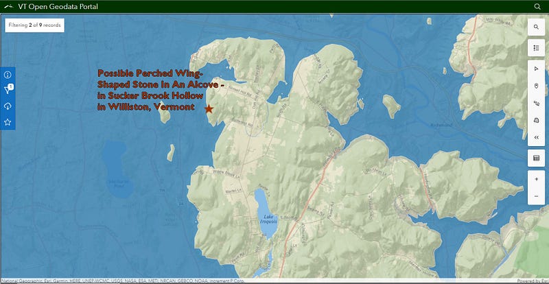
On the map, an inlet to the South leads in behind the Oak View Hill Trails, where I found what looked like an Alcove with a mostly buried, toppled Wing-Shaped Stone, but with an attendant Side Wing still standing.
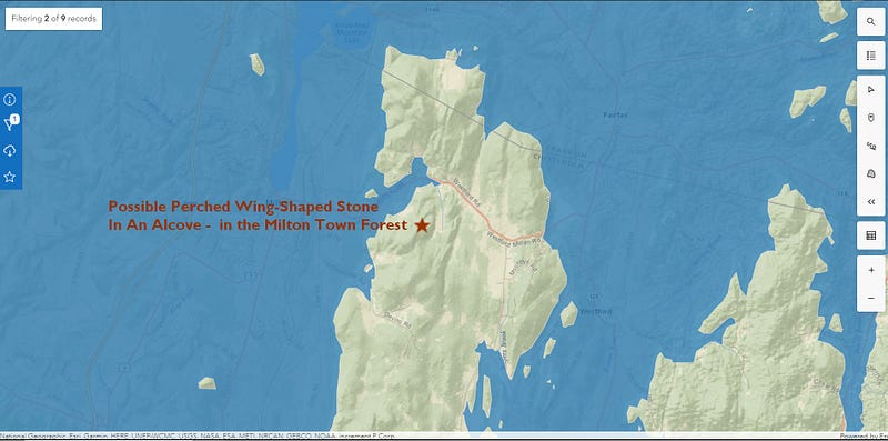
There are more of these apparent features in the Milton Town Forest, also near the Lake Vermont shore in the Coveville Phase.
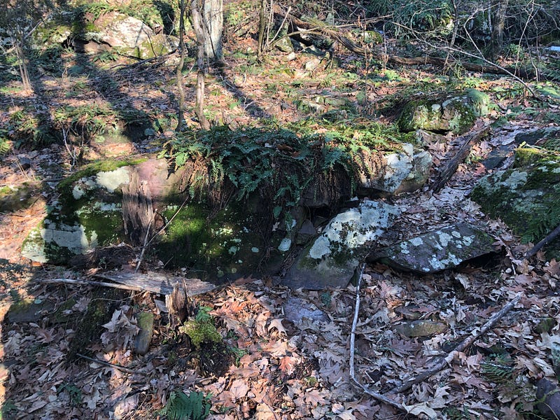
I have found one outlier, in Red Rocks Park in South Burlington. Though near the highest point in the waterfront park, it would have been underwater in all phases of Lake Vermont and during the Champlain Sea, according to the map. There is a wing in an alcove here, as well as an attendant wing on the side, and yet, it does not sit on the shore of Lake Vermont during the Coveville Phase. At least, not according to the map:
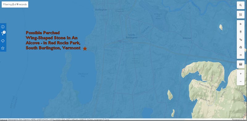
Perhaps this part of the Glacial Lakes map is incorrect. Other geological processes may have later lowered this waterfront area — we are near a fault line, here. Or maybe, near the water and not covered by ice sheets, it always stood higher than assumed, and did not rebound quite so much. This might also mean the amount of habitable land available was greater than assumed during this period of the Ice Age, if the shorelines weren’t as depressed as sections further inland.
At any rate, this one in Red Rocks Park is a bit of an outlier, shared in the interest of transparency and because it is in my Red Rocks video. Plus, I am proposing an admittedly somewhat outlandish theory.
Could the perched wing-shaped stone in an alcove be a stone construct, a human created stone form, possibly erected by a water-based, coastline living, Indigenous People existing on the edge of retreating glacial ice some 14,000 years ago in the Champlain Valley?
I think it could be. And it could be the precursor to thousands of years of working with stone by the indigenous peoples of what’s now northeastern North America.
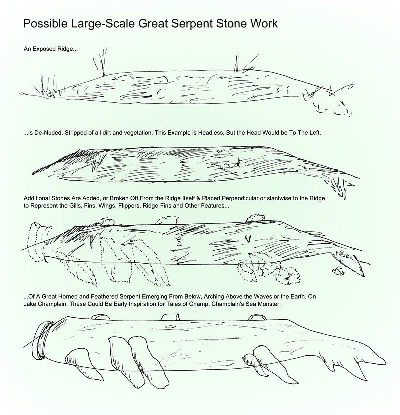
I’ve spoken and written about other ancient theoretical stonework I term Possible Large-Scale Great Serpent Stonework, landscape-sized works where natural outcrops are enhanced with added stones and shaping to become effigy forms. This work seems to occur at a height in the Champlain Valley indicating it could have been done at the time of the Champlain Sea 10,000 years ago.
The Perched Wing-Shaped Stone In An Alcove work could then be older, precursor stonework to the Large Scale Great Serpent Work. What’s coming to be accepted as Ceremonial Stone Landscape work would then follow later, after the possible large scale serpent work.
Once again, this Possible Perched Wing-Shaped Stone in an Alcove stonework form and idea is theoretical, based on my observations around Lake Champlain. As a non-academic observer, I prepare written pieces, photo collections, and video presentations to offer my theories and ideas. I appreciate you taking the time to consider my speculation.
For a video presentation looking into this idea, watch Experiencing A Possibly Ancient Stone Feature and More Oddly Shaped Stones in Saint Albans, Vermont Town Forest on YouTube: https://youtu.be/O-FpWjgMA2I.
Mike Luoma is a Burlington, Vermont based Stone Site Investigator, Author and Researcher, and a member of NEARA — the New England Antiquities Research Association.