


Intriguing Stone Mounds in Williston, Vermont
A Trio of Curious Assemblages - With One Degraded By Mountain Bikes

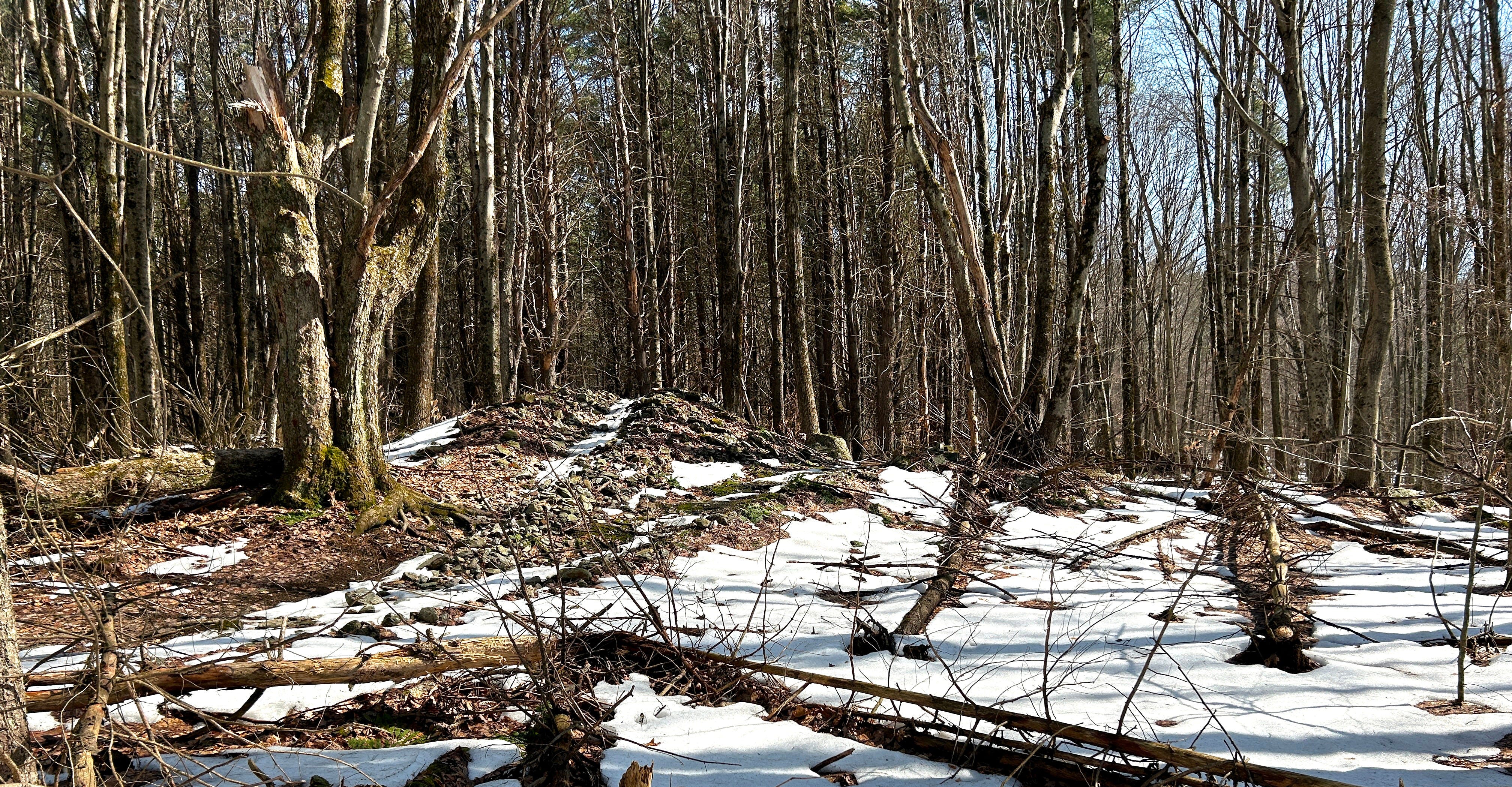
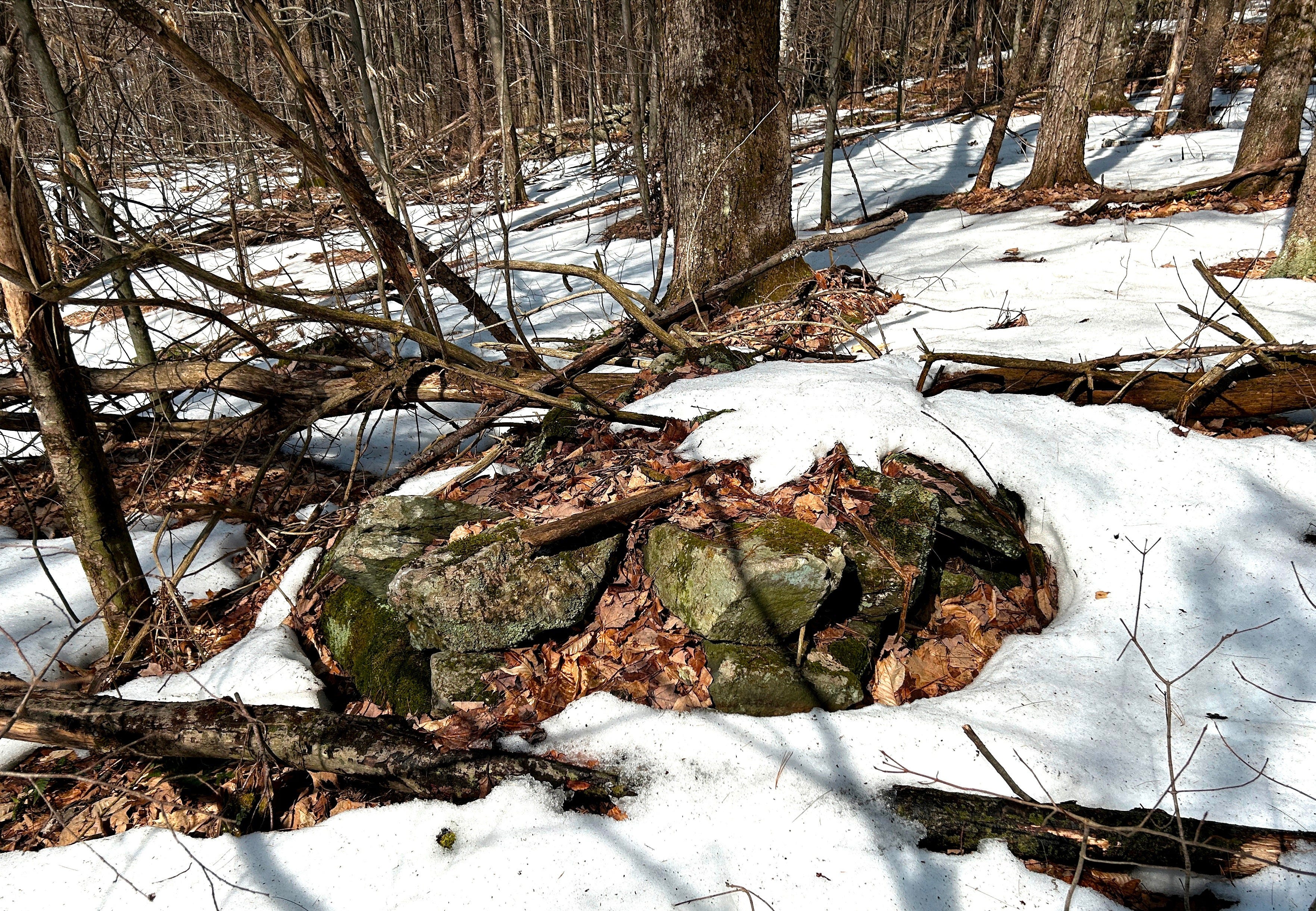
Mountain Bikes and Stone Mounds don’t mix. It usually doesn’t turn out well for the Stone Mounds, at any rate, as we can see in this example from Williston, Vermont. Much as I hate to see this, I can understand why it’s happened — this “Country Park”, as Williston calls its more forested parks, was developed and conserved in part by local Mountain Biking Group Fellowship of the Wheel, and with its switchbacks and loops, the trail system is obviously designed more for riders than hikers.
It’s likely many mountain bike riders figured the Stone Mound was put there just for them to ride on, up and over.
With temperatures nearing 70 degrees, it seemed time to get out and see stonework, so I visited these Three Stone Mounds in Williston, Vermont, just outside of Burlington, on Saturday, though I was hoping more snow would have melted off the landscape than I found to the case when I headed up the trails.
I knew of the degraded Stone Mound from my previous visit to this site. The Second and Third Stone Mounds were new finds this time. It will be nice to circle back in the future to see them with less snow cover.
This is another case where video may show the shape and dimensions better than photos do, so this post will contain a few video clips. Like this one:
The video drifts off to the right just before the end as I noted the land was at the same level, as if there was a platform extending off of the Mound. Or? As if there were a Second Mound over to the right.
In a few minutes, I would discover that there was a Second Stone Mound. And, on past the Second, a Third. The Third Stone Mound was even more surprising to find, as it stood beyond the stone rows which seemed to enclose the area where the other two Mounds, and at least one Potential Stone Prayer, sat.
The stone rows (stone walls) here are curious, as they sometimes display possible Indigenous elements in their lower courses, but in many areas the intact stone rows are topped off in a European fashion, including upright coping stones. The stone rows also meet at squared right angles, which can be determinative of European work for some researchers.
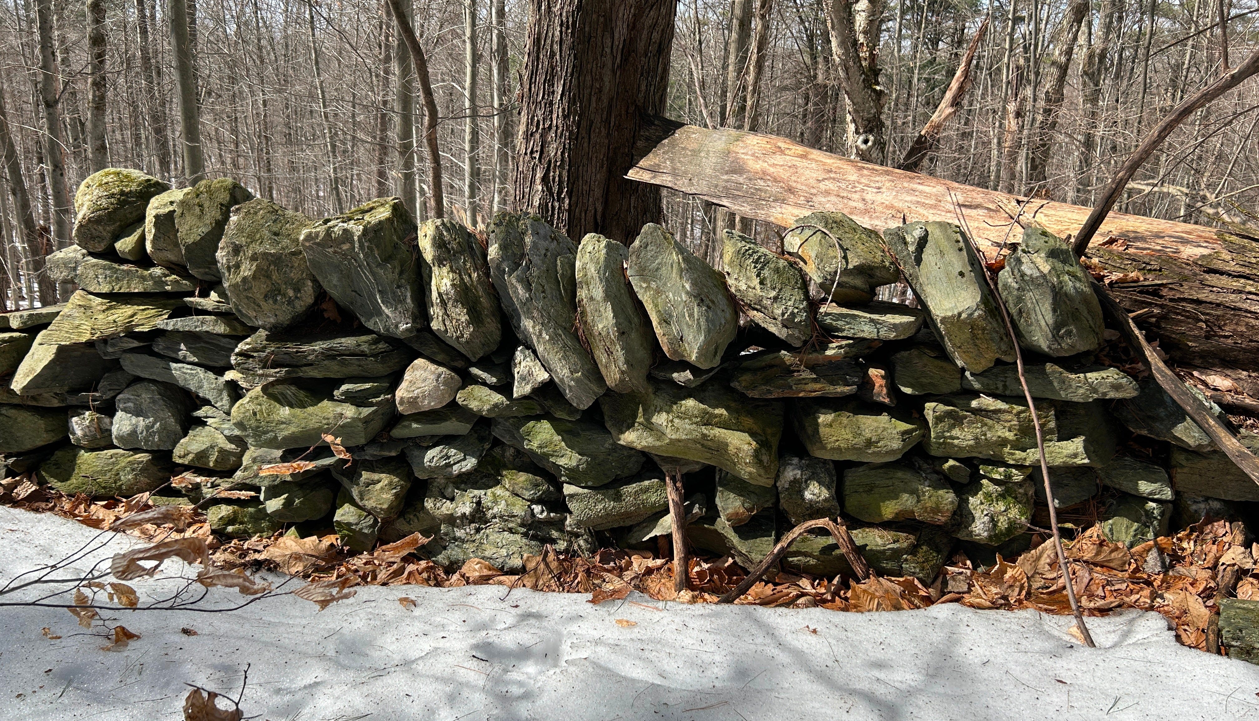
How can there be Indigenous Iconography in the stone rows if this is European-descendant derived stonework? It’s possible later European-descended stone masons “repaired” what were originally Indigenous-built stone rows. It’s also possible Indigenous workers or enslaved people were employed building the original work, and incorporated Indigenous Iconography.
We’ll take a closer look at the questions and possible answers involving the Stone Rows in a future post. Let’s get back to the Stone Mounds.
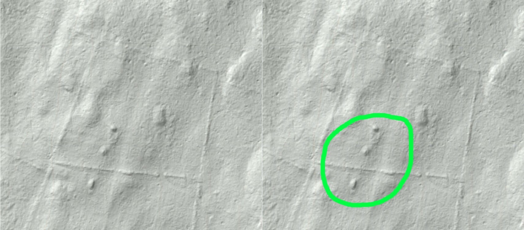
A look at Vermont’s LIDAR Map clearly shows the three Stone Mounds, and the enclosing Stone Rows. This LIDAR map is provided to the public by The Vermont Center for Geographic Information through their VT Interactive Map Viewer at https://maps.vermont.gov/. In simplest terms, LIDAR Maps use laser-derived location data and GPS to show us what the ground would look like with the trees and vegetation removed.
How old are the Mounds? I’m not sure we can tell. They could be older work than most assume. Given what we’ve learned about Indigenous Stonework in the Northeast over the last 50+ years, we now know they could be Ancient Indigenous Stone Assemblages.
We do know they go back a-ways. Old aerial photos are available through the state’s Vermont Open Geodata Portal (https://geodata.vermont.gov/) through The Vermont Center for Geographic Information. In aerial photos from 1942 and 1962, these two fields are still mostly bare of trees, and the Stone Mounds appear to be there. The Mound was not built for Mountain Bikers.


Could these Stone Mounds simply be the remains from clearing fields of stones? I don’t think that’s likely in this case. We can see that the stones the degraded Mound is made up of appear rather small — many small enough to hold in your hand. Prior to mechanized plowing, stones this small were mostly left in the ground. They wouldn’t have been manually cleared into a pile.
Alternatively, though the glaciers left much behind around here, there seems to be too much uniformity to the mix of stones for it to simply be a large pile of Glacial Till.
As the degraded Stone Mound has been biked over repeatedly, I didn’t believe it would mind me walking upon it to gather evidence of its composition for this video:
A closer look at the degraded Stone Mound, again with a look over at the Second Stone Mound, to the Right:
The First Mound from other angles:
The Second Stone Mound:
And the Third Stone Mound:
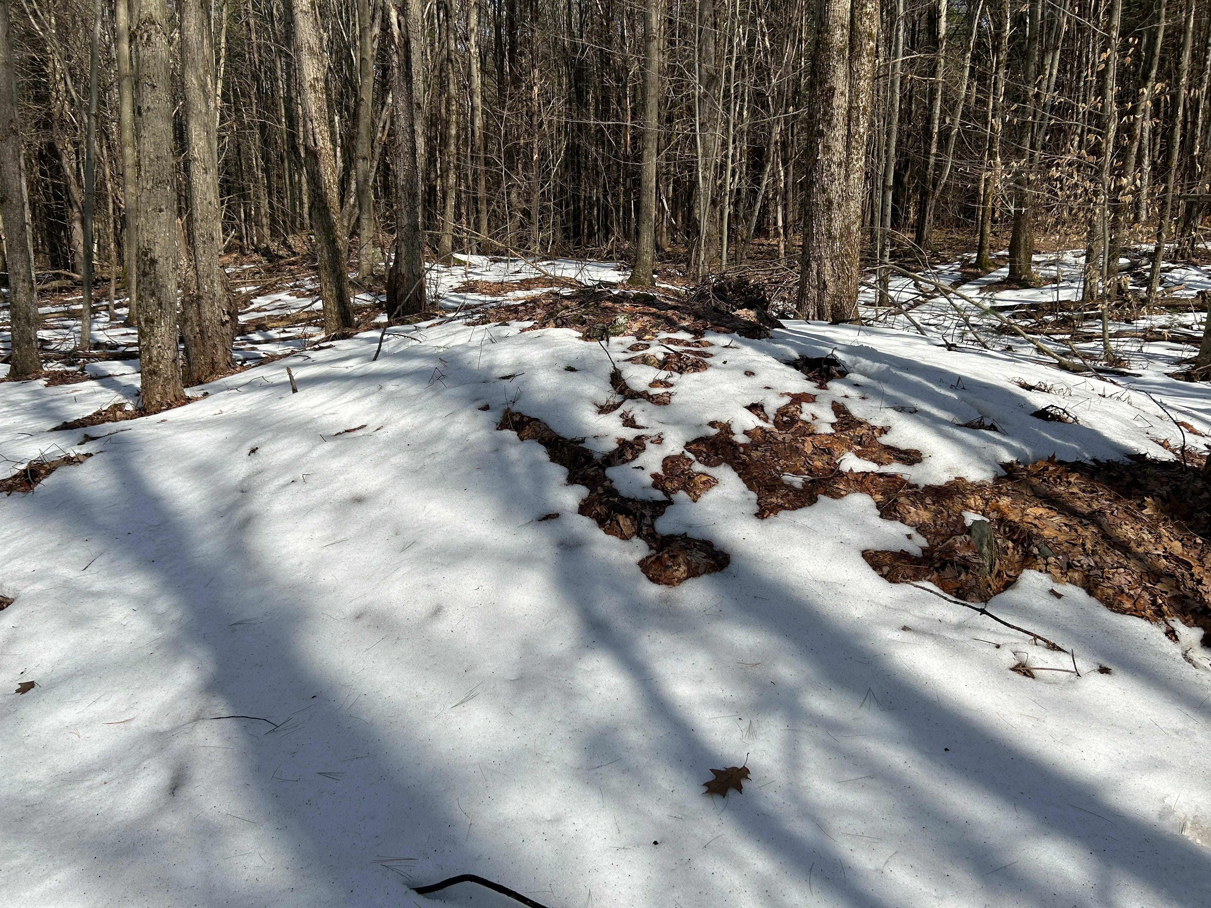
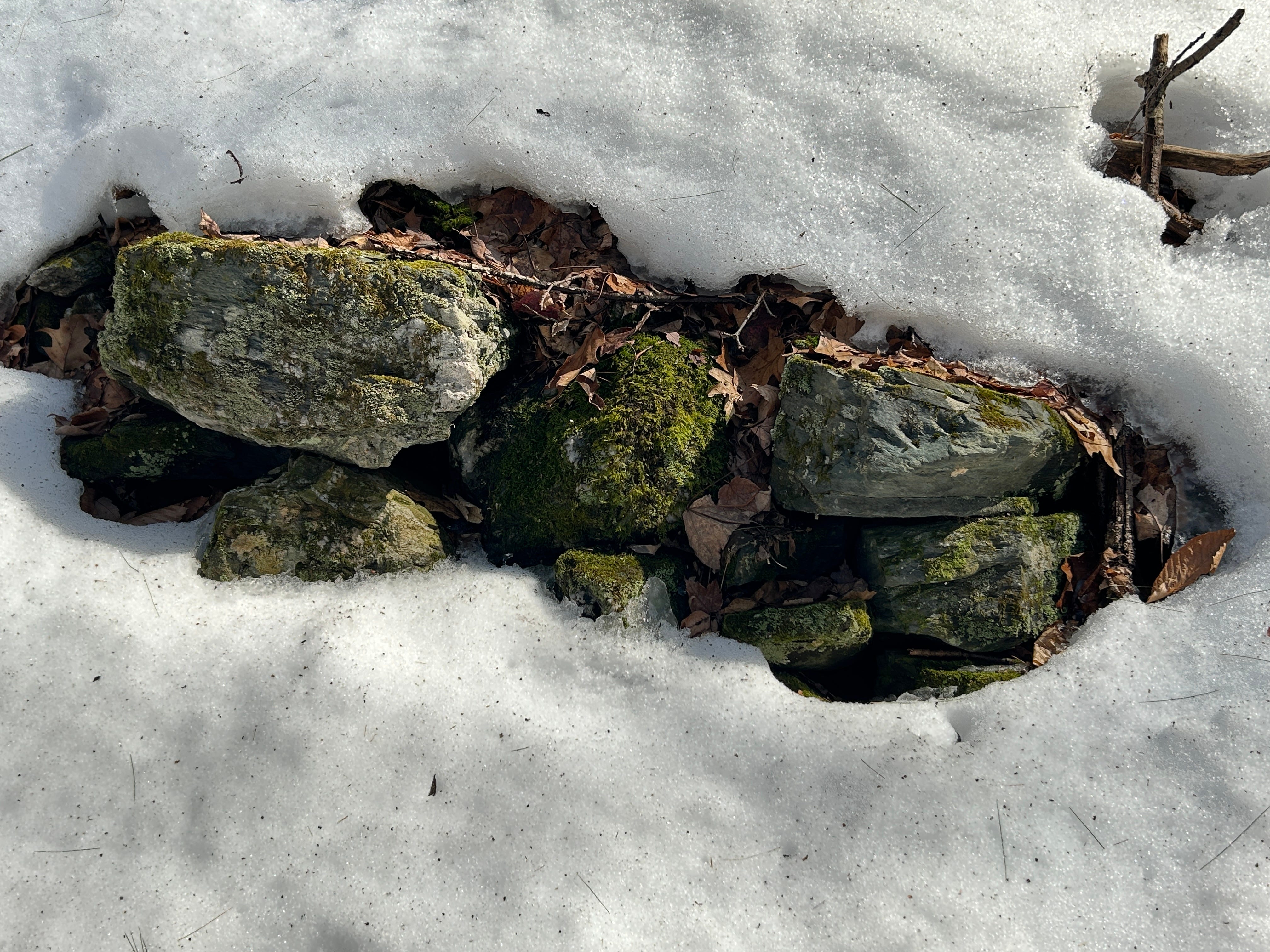
While the Second Stone Mound was still mostly snow-covered, walking around this Third Stone Mound revealed it possessed more structure than the now degraded First Mound displayed.
Even on The Third Mound’s most covered side, stacked stones peek through the snow…
A wide-angle video look at this side of the Third Stone Mound:
Speaking of peeking through the snow, I made another new find nearby, downhill from the First Stone Mound though slightly further north — a possible Stone Prayer.
As we’re getting a little long this time, I’ll likely cover this Stone Prayer mystery in a future post. Look for another on the Stone Rows here as well.
These three Stone Mounds are more mysterious than they may seem at first glance and deserve further investigation. I will return after the snow melts!