


As Seen On TV?
Not Wednesday But Rainy Friday Stonework in Jericho, Vermont

Not Wednesday But Rainy Friday Stonework in Jericho, Vermont
As seen on TV? No. Not really… Though I haven’t watched, I’ve been told the Netflix show WEDNESDAY (as in Wednesday Addams of The Addams Family) takes place in a fictionalized version of my Vermont, in the town of Jericho. But, from what I hear, it’s shot in eastern Europe, and the few pictures I’ve seen do not look like anywhere nearby.
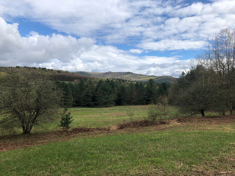
So, no sign of Wednesday in Jericho, Vermont on this rainy Friday afternoon. The weather was a surprise; bright and sunny when I left my home in Burlington, Vermont, by the time I arrived in Jericho twenty minutes later, clouds and a light yet soaking rain had blown in. But I’m determined, or maybe just stubborn, and as the rain was light enough, I put on my hiking boots and headed out on the trails, searching out possible stone serpents in the Jericho woods.
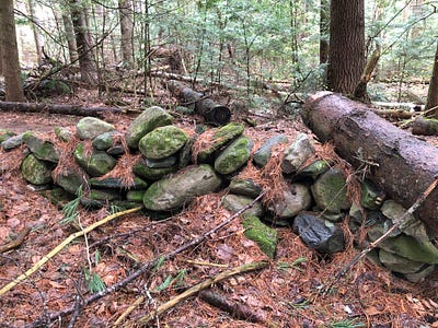
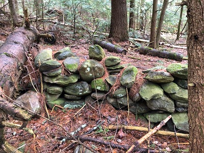
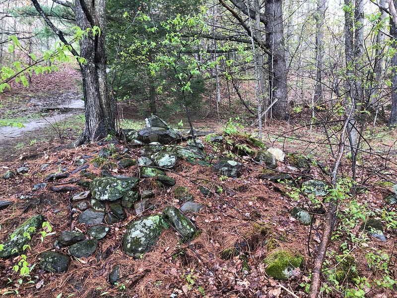
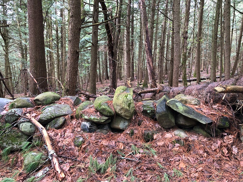
Didn’t find much around this old farm until this old stone row appeared. I came across it from uphill, as it meandered approximately southeast downhill towards a substantial brook.
It’s not very long, and it’s some of the only stonework on this hill, or at least the only still visible (there are a LOT of downed trees here). The only other stones visible are path-lining stones laid out in a serpentine fashion a short distance from this stone row which we’ll look at in a moment, and others in a stone pile, which we’ll also see in a bit.
So this stone row stands curiously alone. And it possesses some interesting characteristics, undulations and iconography, which make it a candidate for a possible effigy work, a potentially ancient Indigenous Serpent Row.
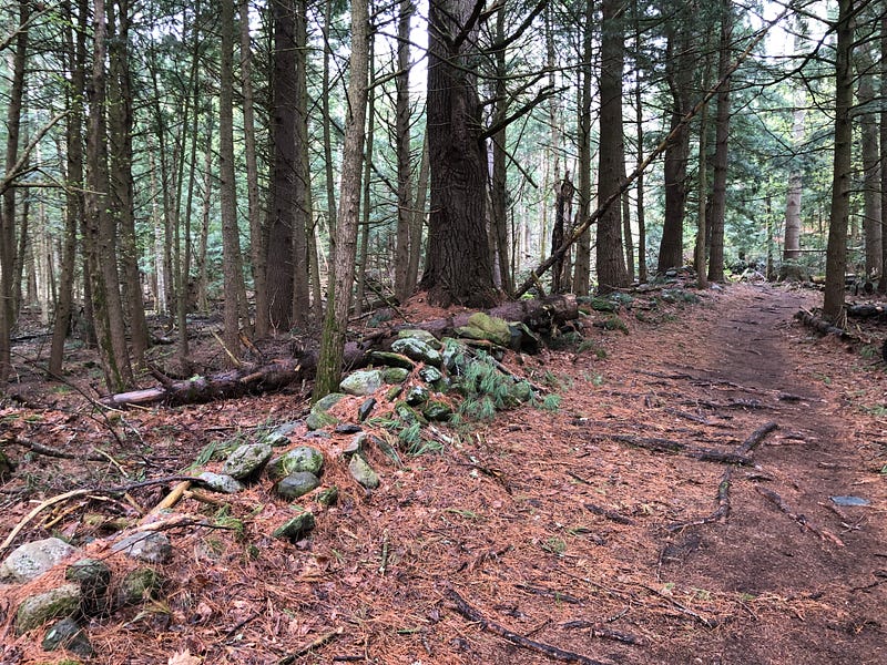
Note the huge old trees next to this stone row, which clearly came along after it was built. That makes the stonework likely to be quite old, indeed.
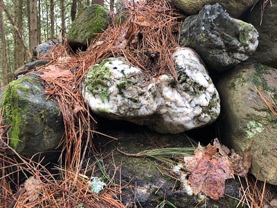
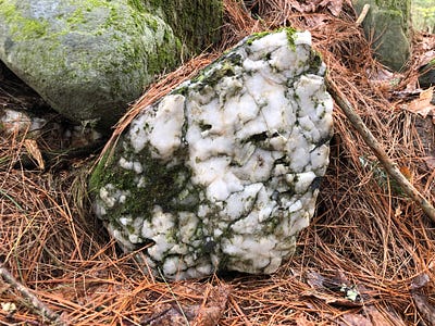
There are also beautiful quartz pieces integrated into the stone row, including one at the center of a circle in one of the few (possible) coils still remaining, one of the upward undulations of the serpent form still visible.
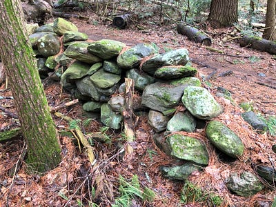
The stones were wet in the rain, and gave a hint of the once-colorful nature of this stone row. There are also other interesting-looking stones with notable veins and inclusions in this row. These are carefully chosen stones.
I crossed the stone row at a low point to get a look at the other side as well.
You see most of what’s still visible of both sides of the stone row here.
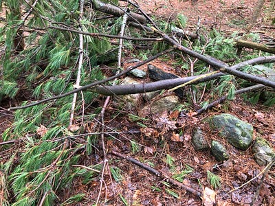
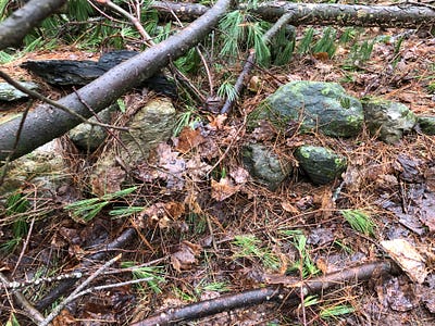
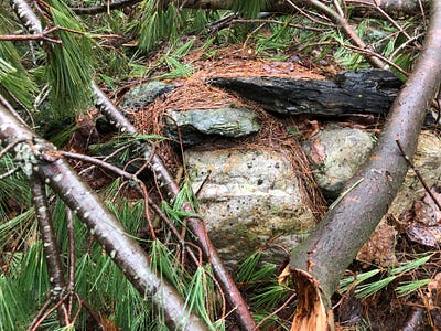
After I crossed back, I found a possible head section remained a little further down, covered in pine branches. I don’t usually disturb things, and these things were all pretty wet, so I tried to shoot through them, best I could.
On the outer edge of the Champlain Valley, this southeast section of Jericho is just above 620 feet, in the first part of the immediate area to deglaciate, according to geologists.
Not to suggest this stone row dates back that far. But it may somehow be commemorative of an ancient shoreline. Additionally, there are places around this hill where there could be terracing and causeway stonework, though with the heavy glacial till found here, it would be hard to differentiate stonework from what the glaciers left behind.
Still, this stone row stands alone. Curious.
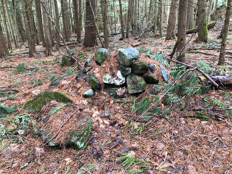
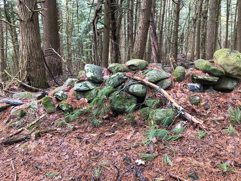
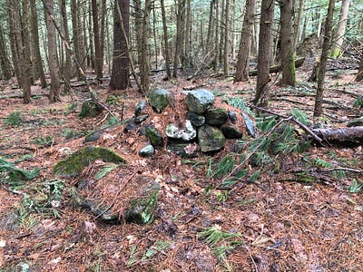
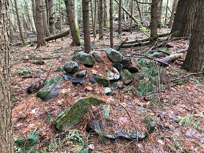
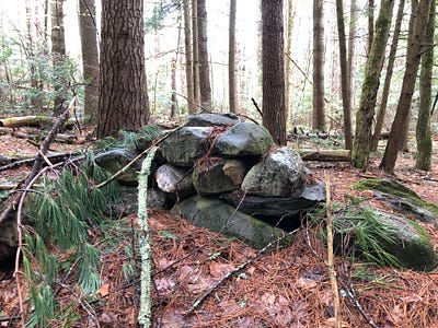
As this stone pile is now found on the edge of a field in Jericho, Vermont, some might give a glance and think “farmer’s clearing pile” and move on.
But it’s not.
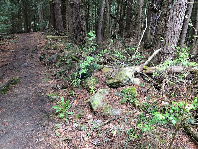
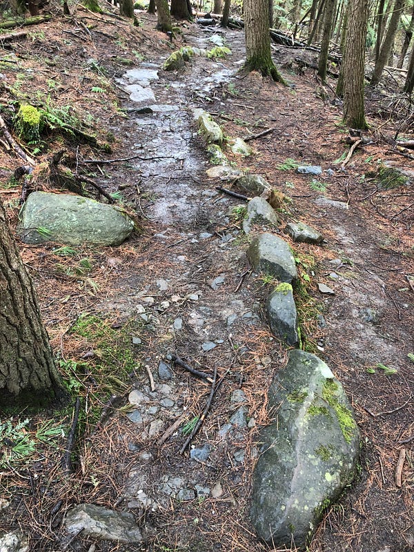
It’s the end of a stone causeway.
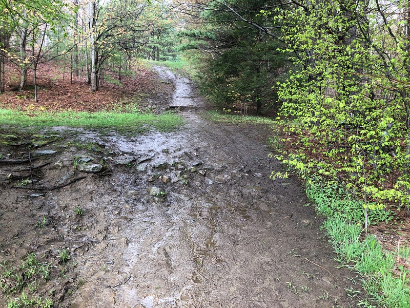
You can see the causeway’s shape, the mud and stones, as the trail crosses it. It’s then visible for a stretch as a step up on the landscape.
And it’s a straight line on the LIDAR. Visibly human-made.
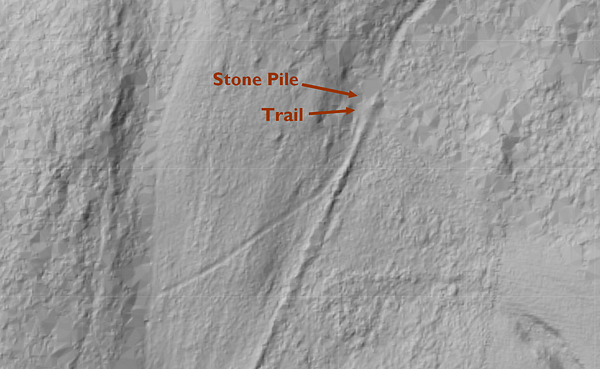
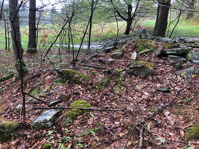
The stones of the end “pile” are curiously arranged, with a quartz-laden, fin-shaped stone stood up atop the mound, and a possible niche on the downhill side.
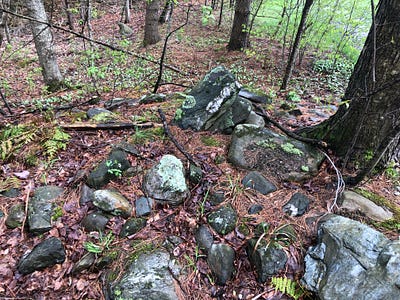
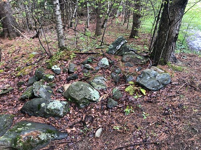
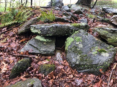
At my most speculative, I note this is at just about 600 feet above sea level, a height which would have put it at sea level, on the shoreline, in the days of the glacial lakes and seas, and I wonder: could this be an ancient, ice age stone dock for a sea-going Indigenous people? And the “pile” a commemorative memorial, as it certainly doesn’t date back that far.
As mentioned above, there are other spots around this hill where there could be more terracing and causeway stonework, but it’s difficult to differentiate possible stonework from what the glaciers left behind.
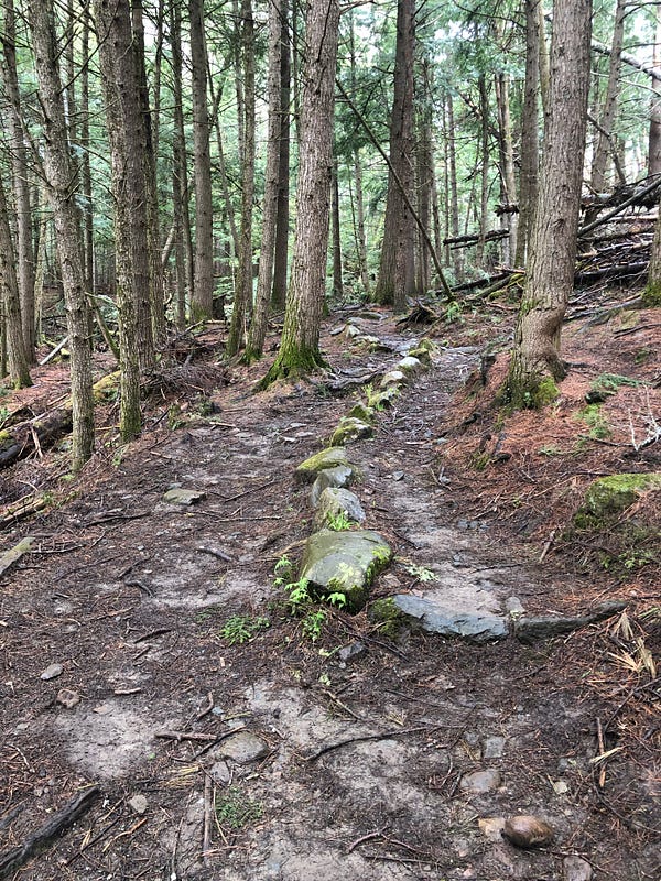
A stone-lined, serpentine path can be found just downhill from the only stone row in the immediate vicinity, the one illustrated earlier.
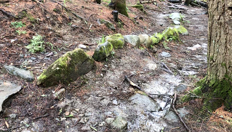
As this was an old farm and, now, these are public trails, there’s no telling when this serpentine walkway was built. Yet it exhibits Indigenous Stone Row iconography, all the same. It may bear some vestigial patterns from the distant past.
I came across a modern stone memorial of sorts making my way back towards my car. The commemorative stonework may have used an old stone Indigenous mortar or grinding stone as it’s top piece. Its new message is now engraved in the ancient, apparently worked surface.
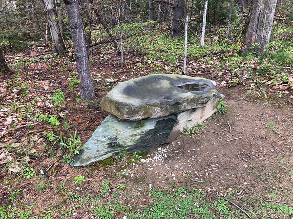
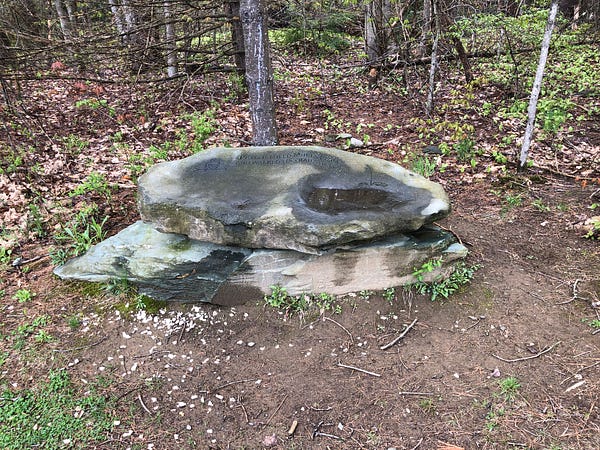
Oddly anachronistic, not quite fitting any time, it still stood as a reminder of our endless human tendencies towards adaptation, and of our seemingly universal human need to grasp at eternity through memorializing ourselves and others in stone.
It was surprising to find only one stone row upon the landscape of this old Vermont farm, though mine was by no means a thorough search on this first visit, in the rain. It may yet merit another visit, though perhaps I may find that, as this is Jericho, the rest the walls… have come tumbling down.
Yes. I went there.
Mike Luoma is a Vermont-based author, researcher and Stone Site Investigator looking into possible Indigenous Stonework in the Northeast of what’s now North America. His new book Ancient Stone Mysteries of New England: Discovering Ancient History All Around Us features over 370 pages, and over 500 black and white photos and illustrations and is available now at Amazon, Barnes & Noble, Bookshop.org and other sites. You can find out more at his http://AncientStoneMysteries.com.