Ancient Cave Art?
Discovering Possible Glyphs in a Burlington, Vermont “Sea Cave”

Discovering Possible Glyphs in a Burlington, Vermont “Sea Cave”
“Is that… something?”
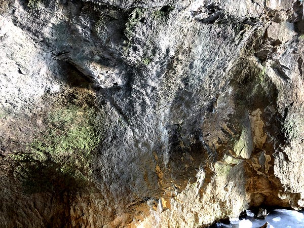
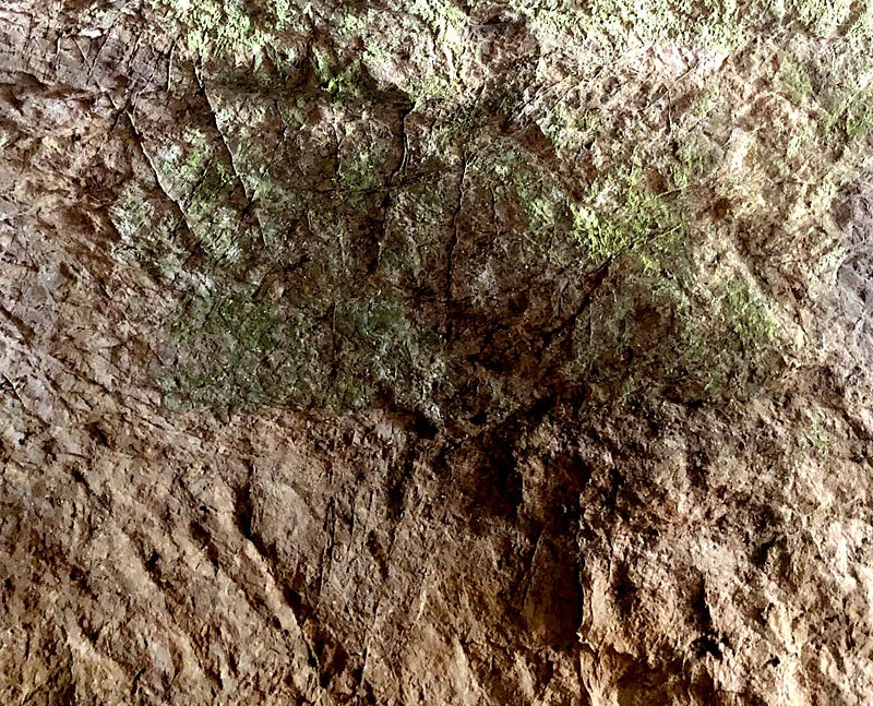
I stared at a scalloped-shell shape seemingly carved into the cave wall in front of me. It was something, all right. Exactly what? That remains a mystery, for now. Opinions differ. But it could be a possible petroglyph or mud glyph — ancient, Native American cave art.
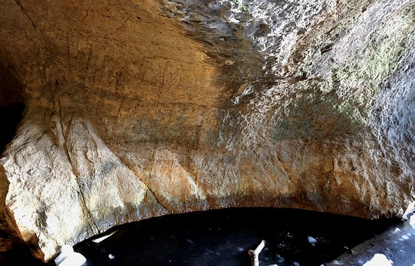
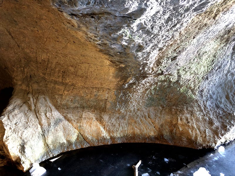
Prehistoric art on a cave wall in Burlington, Vermont?
I made my way back to the Burlington Sea Caves in mid February. This intriguing Vermont site, only accessible on foot during the winter when you can cross frozen pond ice, is also known as the Donahue or Intervale Sea Caves, or “The Devils Den”. I had first visited in January, but the cave floor, covered in about a foot of water, hadn’t yet frozen over. You can read about that first trip to the Sea Caves in Inside the “Devil’s Den”.
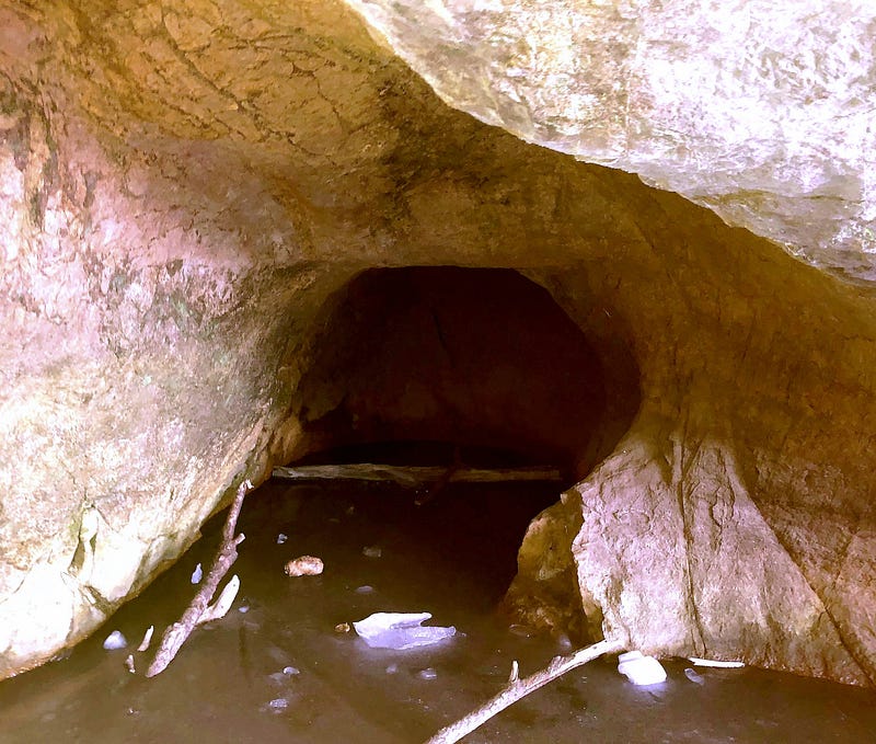
I wanted to get into the back of the cave, to see if it went any further on either side in back (it didn’t). And of course, I wanted to see if there was anything else of note to check out back there. At the very least, I hoped to get video and photos from the back of the cave looking out, for a full perspective.
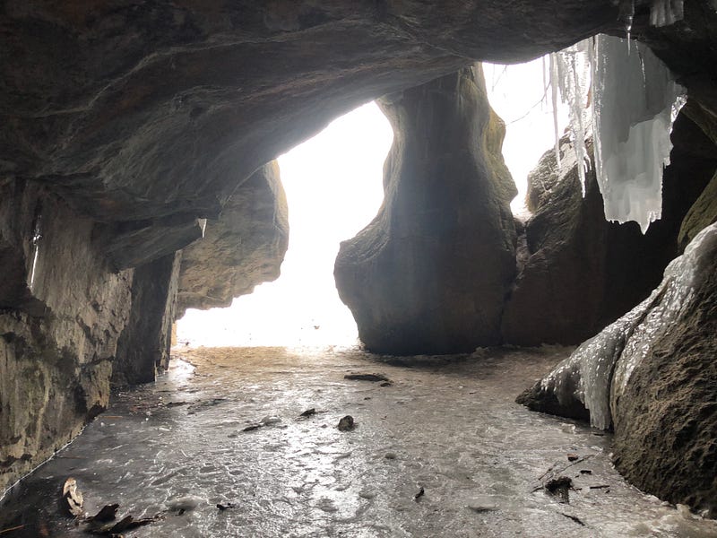
After a cold snap in February , I went back to see if the floor had frozen. I not only found that it had, I also found this possible prehistoric art.
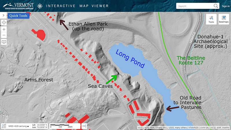
Finding Native American art here doesn’t seem that far-fetched. The Cave is found on the edge of Burlington’s Intervale, the floodplain of the Winooski River, as it meanders towards Lake Champlain.
Archaeologists at the University of Vermont once said the Intervale along these lower miles of the Winooski River contained one of the densest concentrations of archaeological sites anywhere in New England.
These wetlands formed when they ran a highway through the Intervale in the 1970s, cutting off this sliver of land and expanding the size of Long Pond as well. Before that, although boggy, visitors could once “stroll right up to the cavern in dry summers” according to EnjoyBurlington.com, the city website.
Near the cave, on the other side of the highway, archaeologists excavated two sites in the late 1970s. The Donahue site yielded evidence of habitation at the beginning and end of the Woodland Period, with the later dates showing evidence of horticulture, the Abenaki enjoying corn as well as their beloved butternuts. The Abenaki lived here, all along the Winooski River.
Once again, given these surroundings, the appearance of Native American cave art doesn’t seem that farfetched. I am a little surprised no one has reported them before.
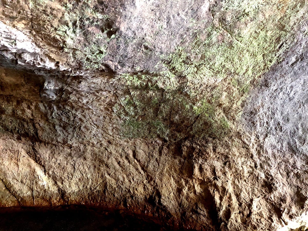
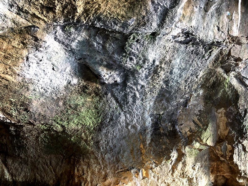
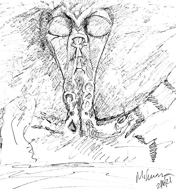
Not only do I see the semi-circular shape, it appears to me a boxy tail continues off to the left of it as the cave wall turns. And to the right of the semi-circular shape, there appears to be larger, additional carving on the wall, possibly a stylized serpent head. I sketched the shapes as I was seeing them.
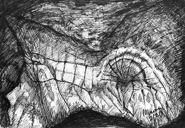
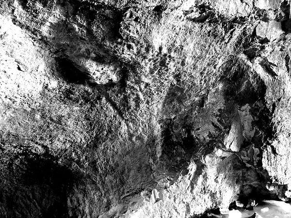
I sent my sketch and photos of the semi-circular feature to a couple of archaeologists for opinions. The semi-circular feature to me seems more obviously evident, and less prone to pareidolia, our mind’s tendency to impose forms, like faces, on inanimate objects — the “uncanny valley” effect.
Dr. Curtiss Hoffman, archaeologist at Bridgewater State University in Massachusetts and author of Stone Prayers: Native American Stone Constructions of the Eastern Seaboard (2018), wasn’t sure about the petroglyph after my initial email, as he felt the lighting in the photo I’d sent didn’t allow him to see what I had drawn, but he was curious enough to allow a couple of follow ups. Upon receiving the The Scalloped-Shell Shape image posted above, Dr. Hoffman replied, “This looks more like the real deal.”
Certainly encouraging.
Vermont State Archaeologist Dr. Jess Robinson, however, didn’t think it was a petroglyph. He replied, “I don’t think that the striations and patterning the images show represent a petroglyph. Petroglyphs are formed through pecking, which leaves distinctive patterning and pocking that these images do not show.” He did mention that, “they may represent some kind of fossil impression, however. I am not a geologist, and so I can’t say what they might represent.”
Not so encouraging.
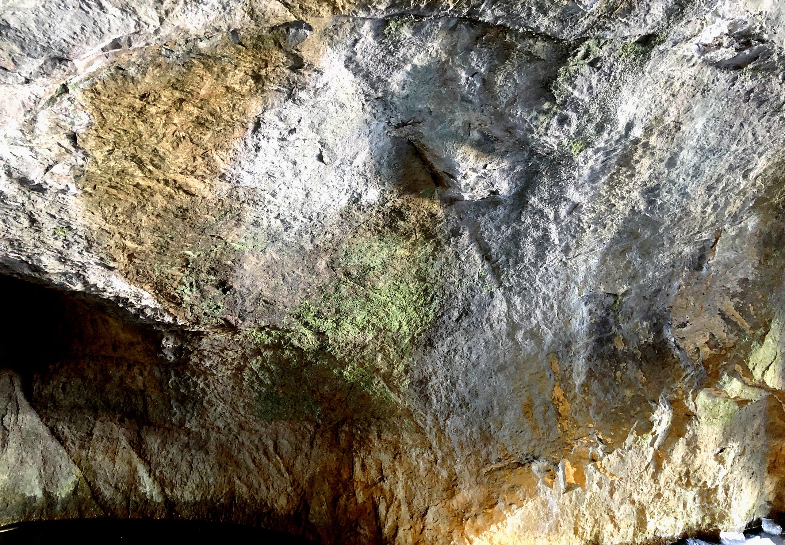
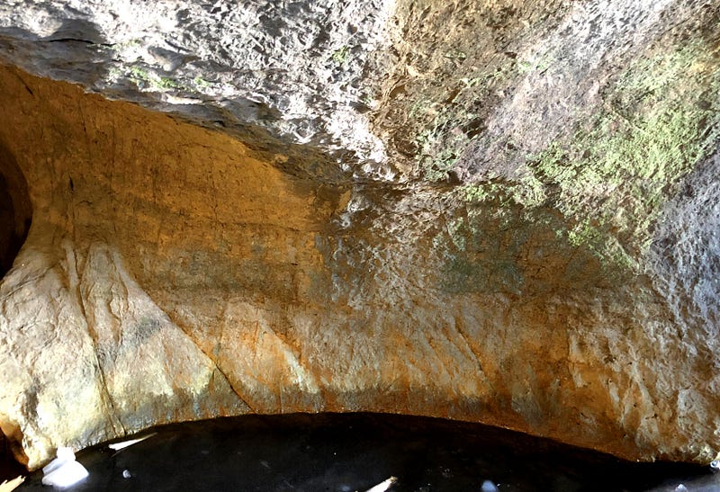
As simply a natural wonder the cavern is beautiful. Most of this rock is a local magnesium rich limestone known as dolostone. Naturally beige to gray in color, eons of erosion — all the wearing work of water — has brought out a stunning array of colors in the rock, and carved smooth, almost organic curves.
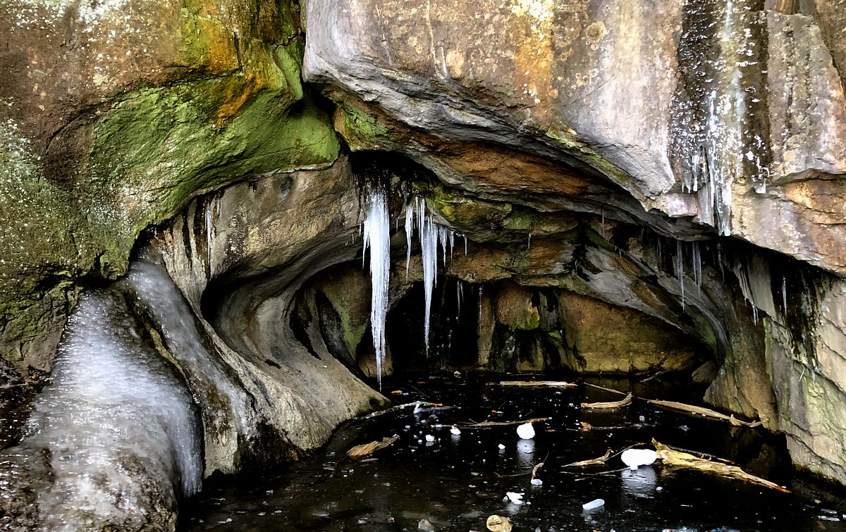
Though there was a sea here at the end of the Ice Age, we’d have been over 100 feet below the surface of the Champlain Sea.
According to geologists, this cave likely wasn’t an actual sea cave, but was instead eroded by the force of the glacial Winooski River cutting away and washing through its former Delta, settling as the Champlain Sea receded.
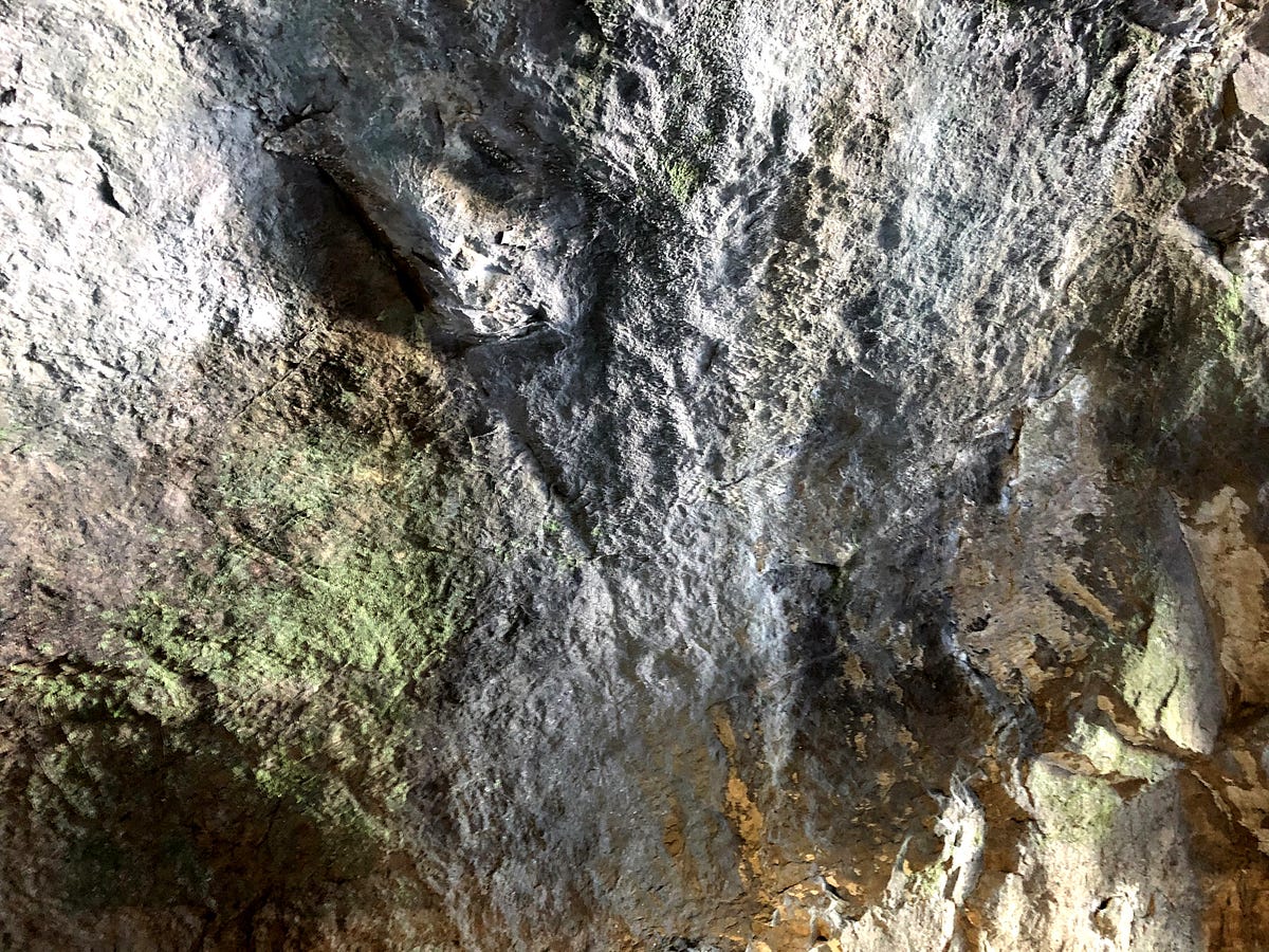
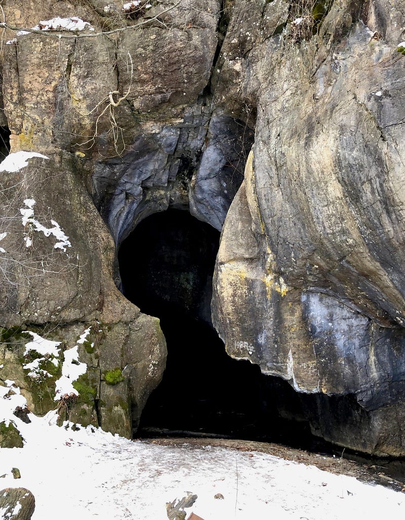
There aren’t really caves, plural, unless we count the little cubbyhole at back right, next to the glyphs, as a second “cave”. The little cavern is about a foot-and-a-half high, and only about that deep. Not really caves.
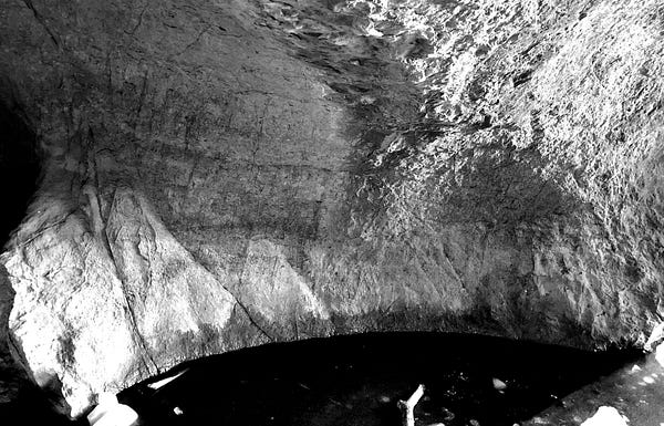
And what I’m showing you may — or may not — be cave art. The experts disagree. The jury is still out, and further study is required. But that won’t be in-person, not right now... with temperatures on the rise, the back of the cave is no longer easily accessible, and may not be again until next winter. Until then, we can study photos and video — I leave you with a few more pictures to pore over. Some are also provided in black and white for greater contrast. Feel free to join in the study by responding with your thoughts to this article, or by getting in touch directly via email. Enjoy!